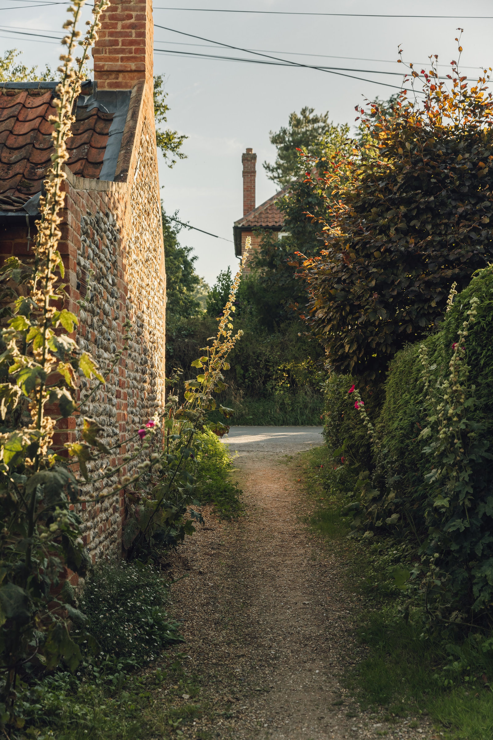
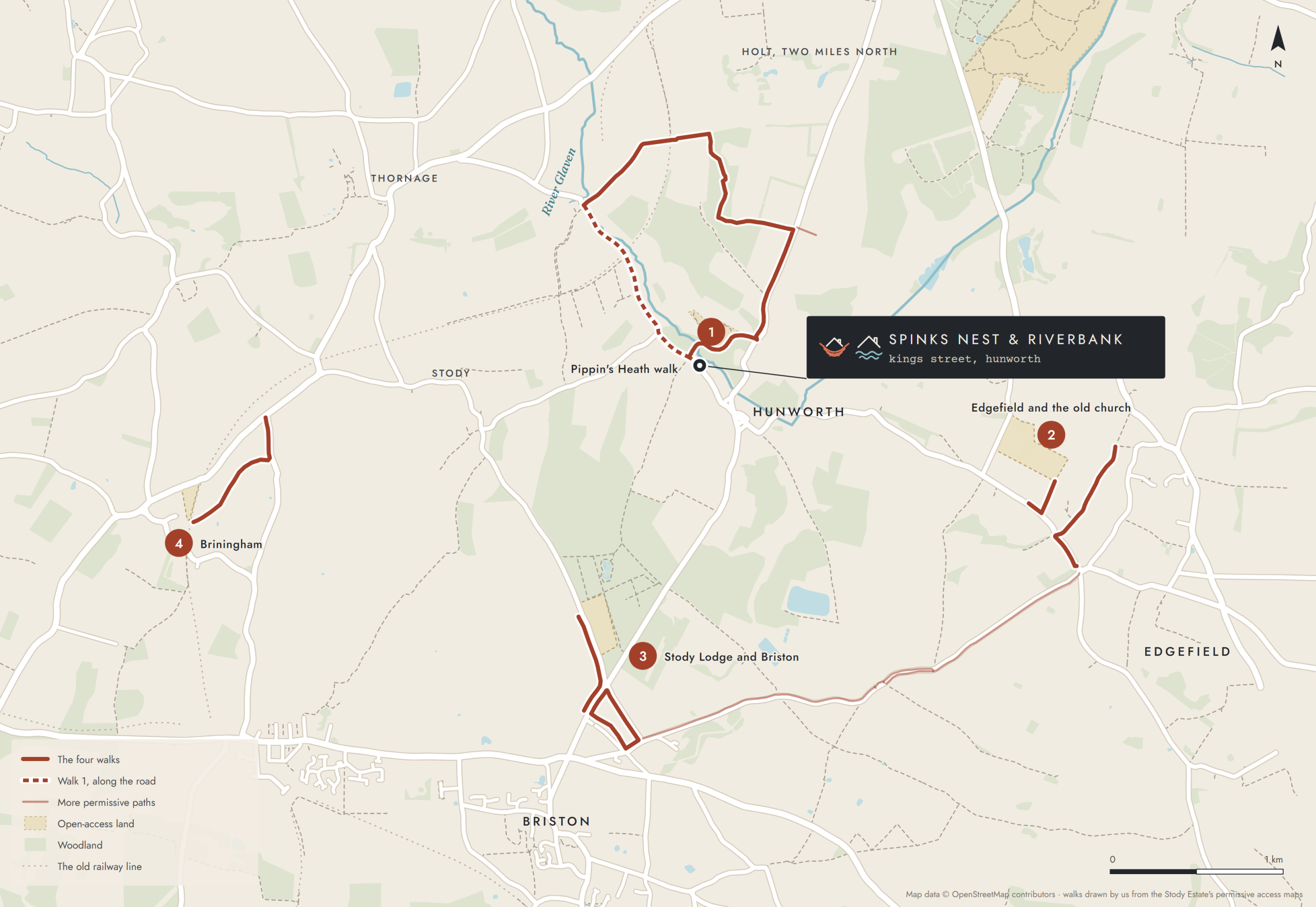
As well as the public footpaths, the Stody Estate, which farms much of the land around Hunworth, keeps a network of permissive paths open for walkers. Here are four walks on them: the first starts at our front door, and the others are a short drive away.
Good to know
- These are permissive paths: the estate allows walkers to use them, but they aren’t public rights of way, and access can be withdrawn.
- Daylight hours only.
- Dogs on a lead at all times, except in the two open-access dog-walking areas near Edgefield and Briston.
- Follow the signs on the ground: the estate’s maps date from 2018, so if a sign says otherwise, the sign wins.
Walk 1 · from the door
The Pippin’s Heath walk, a minute from the door.
A 4.3 km (2¾ mile) loop · allow about 1½ hours · boots for the old lane
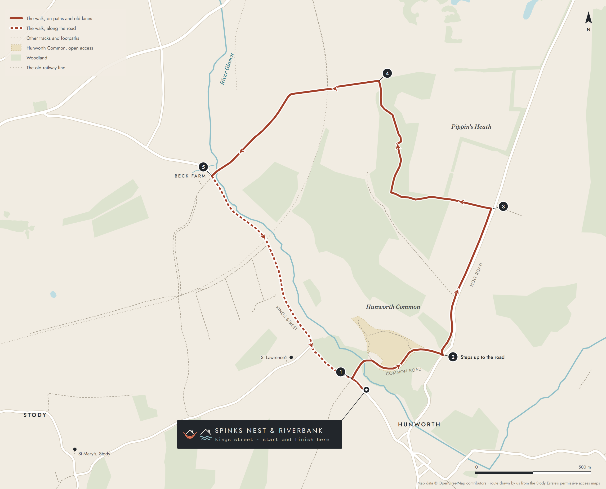
It starts and finishes at our front door, on an old lane through the woods and the Stody Estate’s permissive paths. The numbers match the map.
- Walk down Kings Street and turn right up Common Road, the old lane. It isn’t really a road at all but an unpaved track through the woods, and it can be muddy, so wear boots. It crosses the Glaven at the ford, where there’s a footbridge, and runs through Hunworth Common.
- At the far end, steps take you up to Holt Road. Turn left onto the path that runs alongside the road.
- Where the path leaves the road, follow it left along the field edge, then north through Pippin’s Heath Plantation.
- At the top, turn left. The track runs west along the high ground, crosses the old railway line and drops down to the River Glaven.
- Cross the river to the road at Beck Farm, turn left and follow Kings Street back past St Lawrence’s church to the door. This last stretch is on the road, so keep an eye out for traffic.
Walk 2 · a short drive
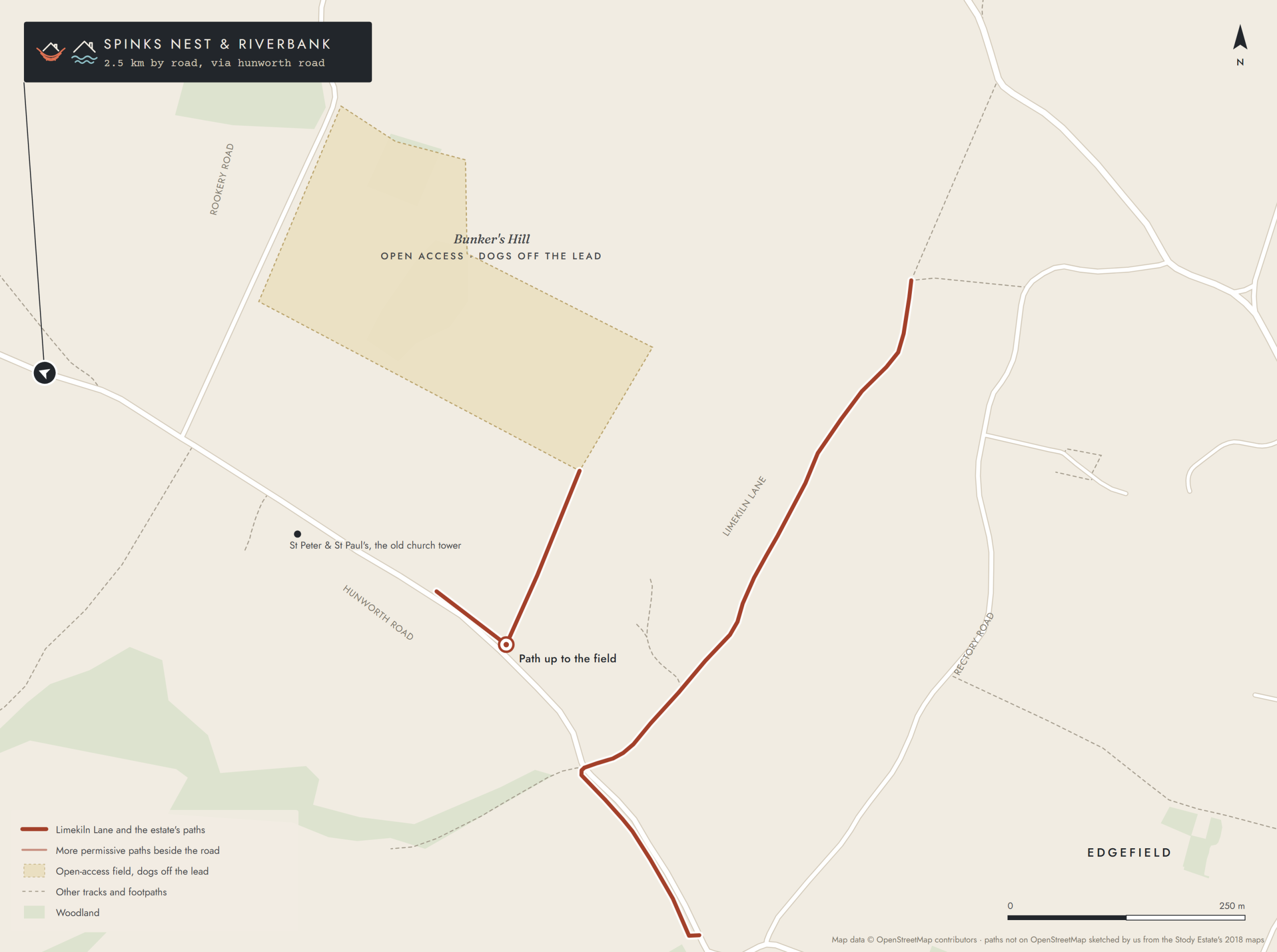
Edgefield and the old church.
2.5 km from the door by road, along the Hunworth road
Limekiln Lane, an old track, runs up from the Hunworth road to Rectory Road on the edge of Edgefield, and a permissive path carries on beside the road towards the village.
A little nearer Hunworth, a short path leads up from the road to an open-access field around Bunker’s Hill, one of the two places on the estate where dogs can run off the lead. Just off the road nearby stands the octagonal tower of St Peter and St Paul’s, all that’s left of Edgefield’s old church: the rest was taken down in the 1880s and rebuilt in the village.
Walk 3 · a short drive
Stody Lodge and Briston.
2 km from the door by road, down Holt Road
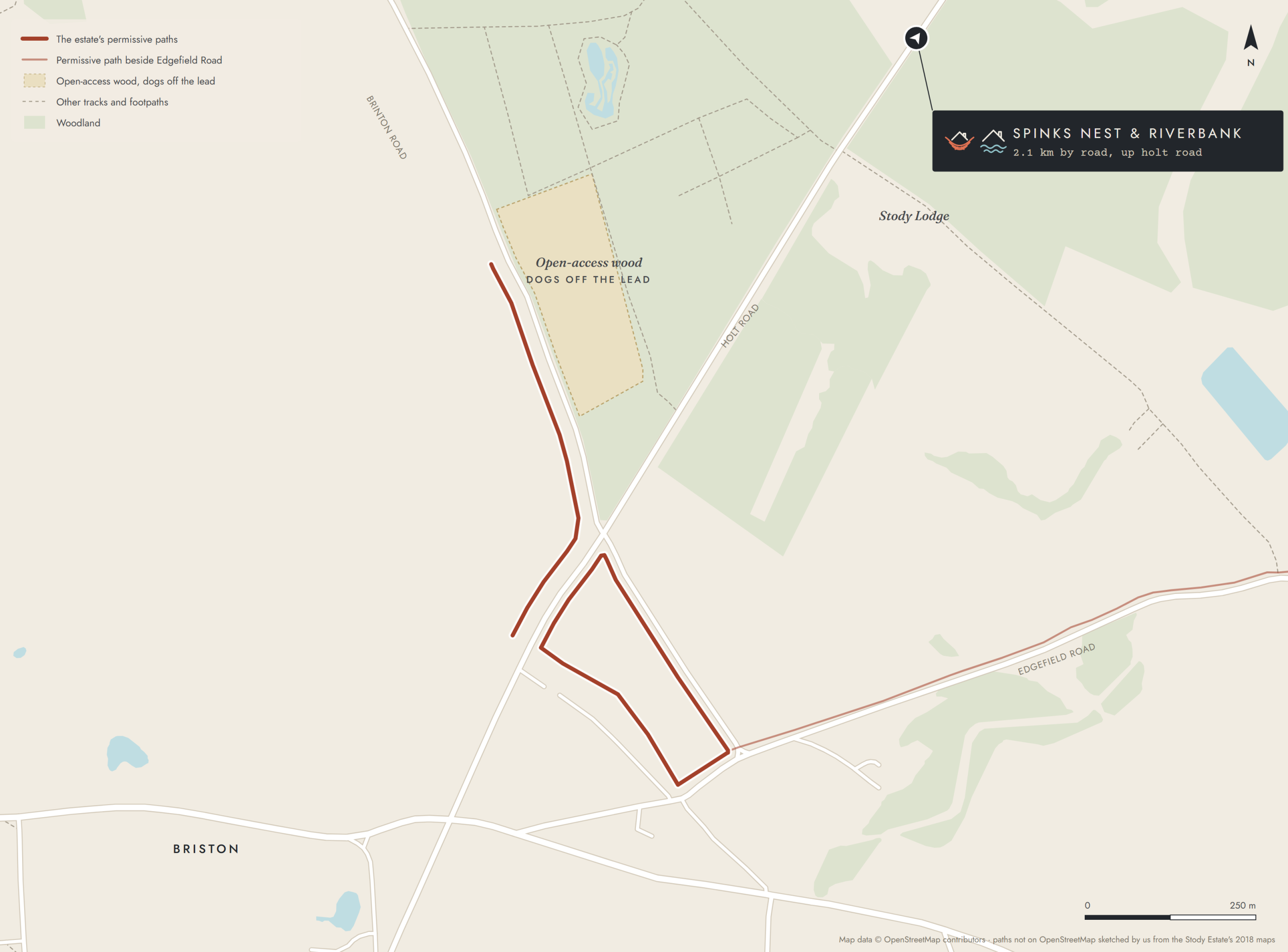
Past Stody Lodge, where Holt Road crosses Brinton Road on the northern edge of Briston, the estate’s paths run through the fields beside both roads, with a short loop between them at the edge of the village.
North of the crossroads, a strip of open-access woodland beside Brinton Road is the other place dogs can run off the lead. And a permissive path runs beside Edgefield Road all the way from Briston to Edgefield, nearly 3 km.
Walk 4 · a short drive
Briningham, along the stream.
4 km from the door by road, through Stody · under 2 km there and back
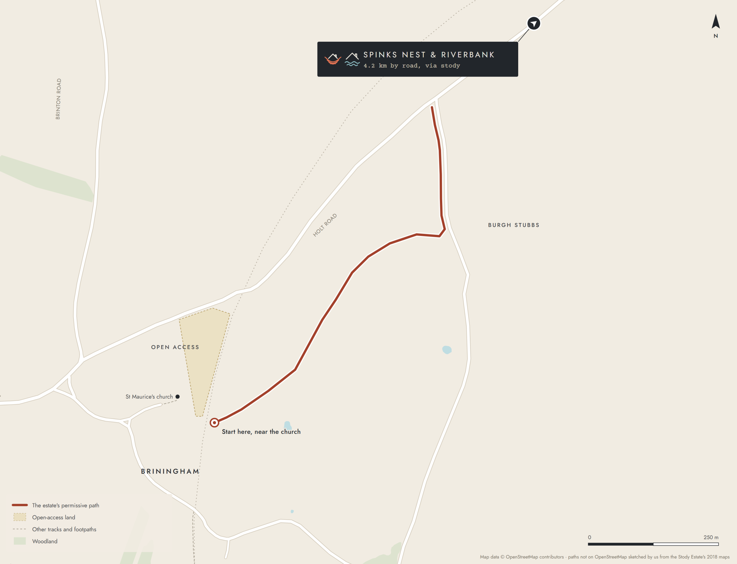
From beside the open-access land next to St Maurice’s church, a path follows the field edges north-east along a little stream to the lane at Burgh Stubbs, then runs north beside the lane to the Holt road.
We used it as a base to explore the coast and it was really well connected while still feeling remote and peaceful.
Our maps are drawn by us on OpenStreetMap data from the Stody Estate’s 2018 permissive access maps, which are in the estate’s PDF. Where a path isn’t on OpenStreetMap we’ve sketched it from the estate’s map, so treat those lines as a guide and follow the waymarks. For walks on the public footpaths too, an Ordnance Survey Explorer map or the OS Maps app is the best companion.
Boots by the door
Walk all day, then the fire.
Spinks Nest sleeps two, and dogs are welcome. Check dates and book directly with us.